2001.07.02
Trinity Alps
I recently spent a week backpacking in the Trinity Alps. The Trinities are in northwest California, and while not quite as high as the Sierra Nevada -- Mt. Thompson tops out at 9002 feet -- they share the same granite and glaciated valleys as their more famous neighbors. A relatively cold microclimate allows for permanent snow fields and remnant glaciers despite the relatively low elevation.
I headed up Canyon Creek, with plans to explore Boulder Creek and the Forbidden Lakes, along with the Canyon Creek lakes themselves.
1 page / 16 photos
2001_07_02_DSCN5638_TrinityAlps_Cropped_Rotated
Sawtooth Mountain
Water is everywhere at this time of year. Here's Sawtooth Mountain reflected in a puddle.
[click for photo enlargement + details]
2001_07_02_DSCN5497_TrinityAlps_Cropped_Detail
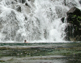
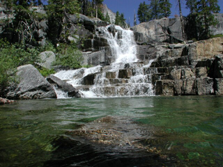
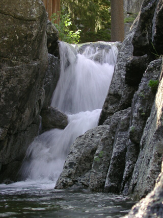
Lower Falls
The hike up the creek was quite hot, and like many backpackers I found respite in the swimming hole at the base of the Lower Falls. It's a great spot to have lunch and recharge, since it's about halfway up the canyon. The alpine water is extremely cold.
[click for photo enlargement + details]
2001_07_02_DSCN5491_TrinityAlps_Rotated_Cropped_Sharpened_Detail
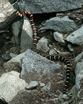
California Mountain Kingsnake
A California Mountain Kingsnake sunning in the rocks. They are strikingly beautiful, with bold red, white and black cross bands. The red bands are bordered on each side with black.
[click for photo enlargement + details]
2001_07_02_DSCN5504_TrinityAlps_Detail
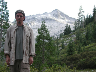
Camp
I made camp just across Canyon Creek, about a quarter mile down Boulder Creek trail. Despite being only a quarter mile off the main Canyon Creek trail -- which gets a lot of use -- there are relatively few visitors to the Boulder Creek watershed. Lots of day hikes are possible from here, both up Boulder Creek and to the Canyon Creek Lakes themselves.
[click for photo enlargement + details]
2001_07_02_DSCN5557_TrinityAlps_Detail
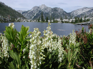
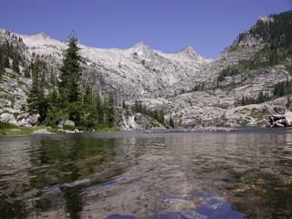
Boulder Creek Lakes
On July 4th I hiked up to Boulder Creek Lakes, which are located in depressions in the granite, scooped out by glaciers. Despite being a holiday, I didn't see a soul all day.
[click for photo enlargement + details]
2001_07_02_DSCN5548_TrinityAlps_Rotated_Detail
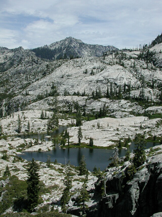
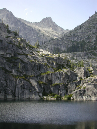
Boulder Creek Lakes
Boulder Creek Lakes and surrounding area. This shot provides a good feel for the vast sheets of granite typical in the Trinity Alps high country.
[click for photo enlargement + details]
2001_07_02_DSCN5540_TrinityAlps_Detail
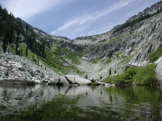
Forbidden Lakes
Around noon I continued heading up the mountain to the Forbidden Lakes, which are in a cirque at the head of a glacial valley. There isn't a trail up to Forbidden Lakes, but occasional cairns and ducks point the way through the granite fields. The surrounding jagged peaks and gentle breeze combine to make a great lunch spot.
[click for photo enlargement + details]
2001_07_02_DSCN5583_TrinityAlps_Detail
Upper Falls Cascade
On Thursday, I hiked up to the Canyon Creek Lakes, which are set in the head end of Canyon Creek valley. Here's part of the Upper Falls cascade, just below the lower lake.
[click for photo enlargement + details]
2001_07_02_DSCN5587_TrinityAlps_Sharpened
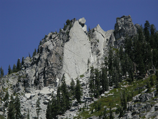
Fracture Plane
A fracture plane (other fracture planes visible in the stone) caused this granite peak to cleave in half, spilling huge boulders down the mountainside. Similar faulting created "The Sinks" down canyon, where the creek temporarily disappears under a granite rubble field.
[click for photo enlargement + details]
2001_07_02_DSCN5603_TrinityAlps_Detail
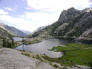
Canyon Creek Lakes
I took a side trip up to El Lake, which is located above Canyon Creek lakes, in the north shadow of Sawtooth Mountain. Here's the view of the Canyon Creek Lakes from the El Lake trail.
[click for photo enlargement + details]
2001_07_02_DSCN5605_TrinityAlps_Detail
Outlet of Upper Lake
Miners built a wood timbered dam here and raised the level of the Upper Lake 6-8 feet. The dam is long gone; however, you can still see the high water "bathtub ring" around the granite bowl of the lake (visible in other photos).
[click for photo enlargement + details]
2001_07_02_DSCN5628_TrinityAlps_Rotated_Detail
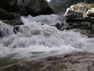
Granite Slot
Canyon Creek alternates from wide and lazy runs through forested flats, to fast runs through narrow granite slots.
[click for photo enlargement + details]
2001_07_02_DSCN5635_TrinityAlps_Rotated_Detail
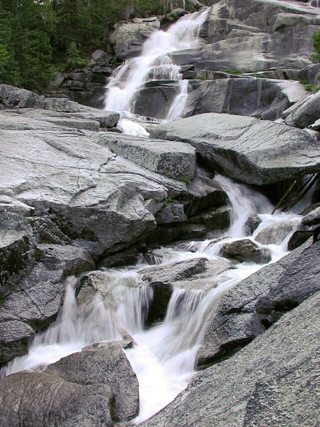
Middle Falls
I was camped at the top of Middle Falls, which is a long series of cascades over massive granite shelves. Overall, it falls about 200 feet in slightly over 1/10 mile.
To understand the scale of the scene, notice that the trees visible in the upper left are probably in the 50 to 70 foot range. The wood scattered in the falls are logs washed downstream during the spring flood.
[click for photo enlargement + details]